
About this article: HomFax™ is a trademark of the Ambassador Claim Handling System and a trading name of Regulus Development Company. Public adjusting services, where provided, are performed by Octavian Payne-Johnson, Texas public insurance adjuster licence #3277221. HomFax is paid for inspection, documentation, estimating, verification and licensing of its technology. We are not paid a percentage of any insurance settlement, and our compensation does not change with the outcome of a claim — we are paid the same whether a property turns out to have no covered damage or a great deal of it. This article is general education for property owners. It is not advice about your specific policy or claim, and reading it does not make you a client.
Ninety minutes over north Tarrant County: what the August 26 storm actually did
An isolated cell formed near Rhome at half past five and was gone by seven. It left quarter-to-ping-pong hail through Haslet and Keller, a commercial roof on the ground in Watauga, and a gap in the instrument record where the strongest wind probably blew.
By The HomFax™ Journal · 2026-08-27
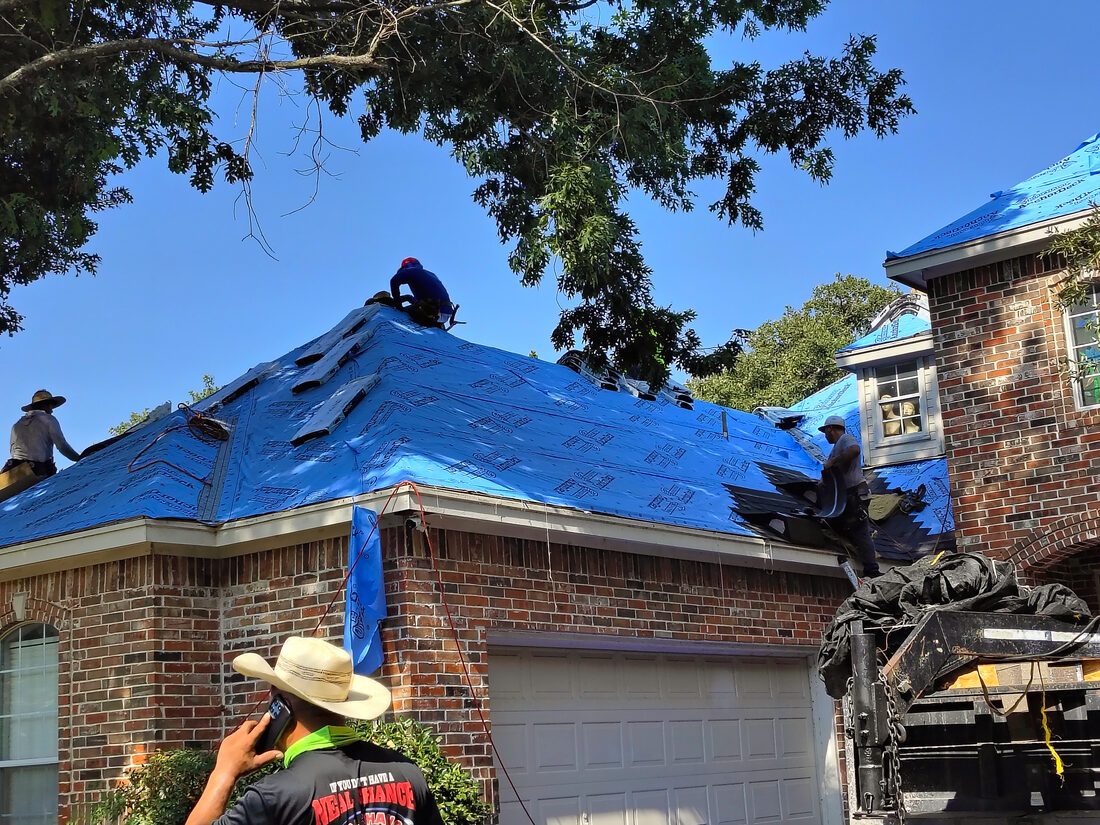
The storm that crossed northern Tarrant County on the evening of Wednesday, 26 August 2026 existed for about ninety minutes.
It formed on a weak cold front over southeastern Wise County, near Rhome, at around half past five in the afternoon. It moved southeast at fifteen to twenty-five miles an hour, across Haslet and the Alliance corridor, over Keller, then through Watauga and North Richland Hills into eastern Tarrant and western Dallas County. By seven o'clock the warnings had expired and the cell was falling apart.
In that time it dropped hail between one and one and a half inches across the Haslet–Keller corridor, put a commercial roof on the ground in Watauga, snapped eight-inch tree limbs beside Interstate 30, destroyed a shed northeast of Rhome, and took roughly six and a half thousand homes off the grid.
It was, by the standards of North Texas, a small storm. It is also the kind that produces the most argument afterwards — because it was narrow, because it moved fast, and because the strongest wind it produced happened in a place where no instrument was standing.
This is the record of what it did, assembled from the products the National Weather Service published while it was happening.
The setup: hot, dry, and primed for a downburst
The morning forecast discussion out of the Fort Worth office was not alarming. A weak front lay across southern Oklahoma, pushing south into North Texas as a mid-level shortwave came in from the northwest. Outflow from a decayed complex over the Panhandle had merged with the boundary overnight.
Forecasters put the chance of storms near the front at only ten to thirty per cent. But they added a specific warning that turned out to matter: a few cells, they wrote, may bring strong winds because of the dry pre-frontal environment.
Afternoon temperatures reached between 99 and 103 degrees ahead of the boundary. That heat, over dry air, produces a deep and well-mixed layer beneath cloud base — and that layer is what turns an ordinary thunderstorm into a wind event. Rain falling into it evaporates, chills the air it falls through, and the resulting parcel becomes heavy enough to accelerate downward. It arrives at the ground as a downburst.
The same dry, high-based structure lets hail survive the fall.
By 6:38 that evening the aviation discussion described an isolated thunderstorm weakening as it moved through the terminal area, with outflow gusts of twenty-five to forty knots — twenty-nine to forty-six miles an hour — still possible before eight.
What developed is best described as an isolated pulse-type severe thunderstorm on a frontal boundary: short-lived, small in footprint, intense in its core. A downburst producer with a hail core. Damage from a storm of this kind is street-by-street. One block loses roofs and the next block loses nothing, and both of those facts are true at the same time.
What the Weather Service warned, and when
Two Severe Thunderstorm Warnings covered the event.
SV.W.0245 was issued at 5:32 PM and ran to 6:30 PM, covering southeastern Wise, southwestern Denton and northern Tarrant counties. It was tagged for 60 mph wind and one-inch hail, both radar-indicated, with the storm near Rhome moving southeast at 15 mph. The locations named in it were Fort Worth, Keller, Haslet, Watauga, Saginaw, Roanoke, Justin, Blue Mound, Northlake, Rhome, North Richland Hills, Trophy Club and Southlake.
At 6:10 PM the office issued a Severe Weather Statement updating that warning, and the update is the important one. The hazard tag changed from radar-indicated to hail observed. The text placed the storm near Haslet, or near Keller, and attributed the upgrade to emergency management: several reports of one inch and greater hail near Keller in far northern Tarrant County. Haslet, Westlake and Marshall Creek were added to the named locations.
SV.W.0246 was issued at 5:58 PM and ran to 7:00 PM, covering eastern Tarrant and west-central Dallas counties, tagged 60 mph and one inch, with the storm over Watauga moving southeast at 25 mph. It named Fort Worth, Keller, Watauga, Haltom City, Hurst, Bedford, Euless, Grapevine, Colleyville, Richland Hills, Arlington, Irving and Grand Prairie.
The first polygon ran roughly from 33.12N/97.55W to 33.21N/97.37W to 32.95N/97.08W to 32.80N/97.40W. Haslet and Keller both sit inside it. Keller was named in all three products.
This distinction is worth holding onto: a warning polygon is an area the Weather Service believed was at risk. A local storm report is a place where somebody stood and observed something. They are different kinds of evidence and they do different work.
The observations: seven official reports
Every entry below comes from the Local Storm Report product issued by the Fort Worth office for 26 August 2026, in Central Daylight Time. These are the records that will eventually populate NOAA Storm Data and the Storm Events Database.
| Time | Event | Magnitude | Location | Source | What was observed |
|---|---|---|---|---|---|
| 5:45 PM | Wind damage | — | 3 NE Rhome, Wise Co. | Amateur radio | Moderate damage to fencing, house siding, small branches near PR 4732 |
| 5:45 PM | Wind damage | — | 4 NE Rhome, Wise Co. | Emergency manager | Trees down on CR-4717 and CR-4730; gutters and shingles torn from a roof; small shed blown from its location and destroyed |
| 5:50 PM | Wind damage | — | 3 WNW Haslet — Sendera Ranch | Emergency manager | Several fences collapsed in the subdivision |
| 5:55 PM | Hail | 1.00″ | 3 NW Keller — Park Vista Blvd & Keller-Haslet Rd | Trained spotter | Dime size with sporadic quarters, far northern Tarrant County |
| 5:59 PM | Hail | 1.50″ | 2 SE Haslet — Alliance / Golden Triangle | Emergency manager | One to one and a half inch hail |
| 6:05 PM | Wind damage | — | 1 ESE Watauga — Rufe Snow Dr & Chapman Rd | Public | Partial roof collapse of a commercial business; power lines over the road |
| 6:22 PM | Wind damage | — | 3 N Pantego — I-30 & Eastchase Pkwy | NWS employee | Eight-inch diameter tree limbs snapped |
Two of the seven came from emergency managers and one from a trained spotter. One came from a Weather Service employee. These are not anonymous phone calls.
The instruments, and the hole in the middle of them
Automated surface observing stations recorded the event from its edges.
| Station | Time | Sustained | Gust | Weather |
|---|---|---|---|---|
| Fort Worth Alliance (KAFW) | 5:48 PM | 14 mph | 26 mph | Thunderstorm, 0.23″ rain |
| Fort Worth Alliance (KAFW) | 6:31 PM | 6 mph | 16 mph | Heavy thunderstorm rain |
| Meacham (KFTW) | 6:16 PM | 29 mph | 46 mph | Thunderstorm in vicinity, haze |
| DFW International (KDFW) | 6:25 PM | 30 mph | 38 mph | Light thunderstorm rain, squall |
| Arlington (KGKY) | 6:53 PM | 15 mph | 36 mph | Light thunderstorm rain |
Read those numbers and you would conclude this was a moderate storm. Forty-six miles an hour at Meacham. Thirty-eight at DFW. Nothing that would take a roof off.
Now look at where those stations are. Alliance recorded 26 mph while the thunderstorm was directly overhead — because the outflow core passed to its east and south, missing the sensor. Meacham was on the storm's western flank. DFW was downstream. Arlington caught it late, on the way out.
The strongest wind of the evening happened between the instruments. A broadcast meteorologist estimated a seventy mile per hour downburst over Watauga. There is no anemometer in Watauga.
This is not a conspiracy; it is the ordinary geometry of weather observation in a metropolitan area. Automated stations sit at airports, and storms do not route themselves over airports. But it produces a specific and predictable argument afterwards, which is that the wind was only forty miles an hour because that is what the nearest official instrument recorded.
The physical evidence says otherwise. A partial commercial roof collapse. A shed lifted from its location and destroyed. Eight-inch tree limbs snapped. Fence lines flattened across a subdivision. Those are the effects of severe-criteria wind — the fifty-eight mile per hour threshold — regardless of what a sensor four miles away happened to feel.
The absence of a measurement is not evidence of absence. It is an absence of evidence, and the distinction matters enormously to anyone who has to describe this evening later.
What the media documented
Local coverage adds detail the official products do not carry.
FOX 4 reported that Haslet activated its outdoor warning sirens for hail, that pea-size hail fell at the Fort Worth–Watauga border and at Rhome, that trees and roofs were damaged, and that power-station damage in Keller was photographed. Oncor reported 6,472 customers without power in Tarrant County at 6:30 PM. Afternoon highs were 99 to 103 degrees.
NBC 5 carried meteorologist Grant Johnston's estimate of a seventy mile per hour downburst, along with downed power lines and broken windows in Watauga, at least one business heavily damaged on Rufe Snow Drive, and metal debris scattered. Hail was reported in North Richland Hills and Fort Worth. Thousands lost power; a few hundred were still out by Thursday morning. The Weather Service had not released a final wind assessment.
WFAA reported a damaged storefront and downed power lines, describing extensive damage in parts of Tarrant County.
One practical note for anyone checking third-party hail maps for this date: as of 26 and 27 August, the commercial hail aggregators had not yet ingested these reports. Their maps typically refresh within twenty-four to seventy-two hours. A map that shows nothing for 26 August is showing you its own update schedule, not the weather.
The corridor
Reconstructing the track from the warning motion vectors — 326 degrees at 12 knots at 5:32, 318 at 20 knots at 5:57, 325 at 13 knots at 6:09 — and the observation points gives this sequence:
- 5:45 PM — Rhome, near PR 4732 and CR-4717/4730 in Wise County. Roofing, siding, fencing and an outbuilding.
- 5:50 PM — Sendera Ranch, Haslet (76052). Fences down as the core entered northern Tarrant.
- 5:55 PM — Park Vista Boulevard at Keller-Haslet Road (76244, 76248). One inch hail, dime with quarters.
- 5:59 PM — Alliance and the Golden Triangle (76177, 76052). One to one and a half inches, confirmed by emergency management.
- 6:05 PM — Rufe Snow Drive at Chapman Road, Watauga (76148). The downburst, the commercial roof, the power lines.
- ~6:10 PM — North Richland Hills, Haltom City, Richland Hills. Hail and wind, per media.
- 6:22 PM — I-30 at Eastchase Parkway, east Fort Worth (76120). Eight-inch limbs.
The hail corridor is estimated at two to four miles wide, centred on a line from Sendera Ranch through Alliance to north Keller. The wind footprint is estimated at one to three miles wide over Watauga and North Richland Hills, with secondary pockets northeast of Rhome and along I-30 to the east.
Those widths are an inference from how pulse storms behave, not a measured swath. Lateral tolerance is roughly a mile and a half either side; times are good to about five minutes.
The ZIP codes touched by the corridor: 76052 Haslet, 76177 Alliance and north Fort Worth, 76244 and 76248 Keller, 76131 Saginaw and Sendera, 76148 Watauga, 76180 and 76182 North Richland Hills, 76117 Haltom City, 76078 Rhome, and — at the polygon's edge — 76262 Roanoke and Trophy Club and 76226 Northlake and Argyle.
What hail of this size actually does
This is the part that matters whether you own the building or repair it, because the thresholds are physical and reasonably well established.
Around three quarters of an inch, hail begins denting soft metals — gutters, downspouts, roof vents, the fins on an air conditioning condenser, window wraps and screens. Soft metal is the most useful evidence on a property because it records impact honestly and it cannot be confused with age.
At about one inch, asphalt shingles begin to sustain mat fracture and granule loss. The fibreglass mat inside the shingle cracks under impact without necessarily breaking the surface. Granules — the shingle's protection against ultraviolet light — are knocked loose and wash into the gutters. Neither failure leaks on the day. Both shorten the life of the roof, and both are difficult to see from the ground.
This storm produced one inch at Park Vista and Keller-Haslet, and one and a half inches at Alliance. Both figures are above the mat-fracture threshold, and the Alliance report came from an emergency manager.
At sixty miles an hour and above, wind creases shingles, lifts ridge caps, breaks the seal strips that bond each shingle to the one below it, detaches gutters and downspouts, and takes fence panels down. A creased shingle looks intact from the driveway and has already failed.
The Watauga roof collapse points to commercial exposure — membrane and metal panel systems, and the scattered metal debris described in the coverage suggests roof panel or equipment screen detachment.
And the electrical side deserves a look that it usually does not get. A damaged power station in Keller and six and a half thousand outages means surge conditions across a wide area. Air conditioning equipment, appliances and electronics can be damaged by surge. Whether that is covered depends entirely on the policy language, and it is worth reading rather than assuming.
If you own a building in the corridor
Nothing here requires you to hire anyone.
Look at the soft metal first. Gutters, downspouts, vents, the air conditioning condenser fins, window screens. Round dents on those mean the roof took the same impacts. This is the check almost everyone skips and it is the most informative one you can do from the ground.
Photograph everything now, with dates. Your phone stamps time and location into the file. A photograph taken this week is a different kind of document from a photograph taken in six months, and the difference is not sentimental — it is evidentiary.
Look along the roofline from the street. A shingle sitting slightly proud of the course below it is a broken seal strip.
Check the attic on a bright day with the lights off, for pinpoints of daylight and for dark staining on the decking.
Write down the date. 26 August 2026. Texas policies commonly carry a suit-limitation provision of two years, and the Insurance Code sets a two-year limitations period for claims under chapter 541. Separately and usually sooner, policies require notice of loss promptly or as soon as practicable. The clock starts from the date of loss, and the date of loss for this event is fixed by seven official observations between 5:45 and 6:22 that evening.
There were earlier events this year worth distinguishing from this one — a 61 mph wind report at Haslet on 18 April, and 1.25 inch hail at Keller and Southlake on 28 April. Fresh impact looks different from old impact: bruising with an intact granule bed around it, bright metal at the base of a dent. If your roof has been hit more than once this year, that history is part of the record rather than a complication to hide.
If you repair buildings in the corridor
The documentation standard that survives scrutiny is not complicated, and it is the same standard whether or not a claim ever follows.
Test squares on every slope. Ten feet by ten feet, marked, photographed, counted. All slopes, not only the ones with obvious damage — the absence of impacts on a leeward slope is itself a finding, and it is what makes the windward count credible.
Directional photography. This cell moved from northwest to southeast, which means the heaviest strikes should be on north- and west-facing slopes and elevations. A photograph set that shows that pattern is consistent with the meteorology. One that does not is worth understanding before anyone else asks about it.
Collateral before conclusions. Soft metals, screens, fence panels, the condenser. Collateral damage corroborates roof damage and it is much harder to attribute to age.
Record the date and the source, not just the damage. The warning numbers are SV.W.0245 and SV.W.0246. The observations are in the Local Storm Report product for 26 August. Those are public records with fixed identifiers, and a file that cites them is a file that can be checked.
Radar is available to you. Level II data from the Fort Worth radar for 22:30 to 23:30 UTC covers this event, and maximum estimated hail size derived from it can exceed ground reports — ground reports depend on somebody being outside, looking, and calling it in. The highest confirmed report here is the emergency manager's inch and a half near Alliance. That is a floor, not a ceiling.
Where claims from this storm commonly get disputed
None of what follows is advice about any particular claim. It is a description of three arguments that recur after narrow, fast-moving storms, and of the public evidence that bears on each. Knowing them in advance is the difference between being surprised by a letter and recognising it.
"No hail was reported at your address."
Seven observations exist for this storm. Seven. A metropolitan county holds hundreds of thousands of buildings, and hail does not fall only where someone was standing outside with a ruler.
A local storm report marks a place where a human being observed something and called it in. It is not a boundary. The warning polygons — SV.W.0245 and SV.W.0246 — describe the area the Weather Service assessed as being at risk, and they cover a great deal more ground than seven pins.
Radar carries this further. Maximum estimated hail size is derived from Level II data across the whole scanned volume, not from the places people happened to be looking, and it is available for this event for the period 22:30 to 23:30 UTC. Where the radar-derived estimate and the ground reports disagree, both are evidence and the disagreement itself is informative.
"The wind was only forty miles an hour."
This one is answered by the map more than by the argument. Meacham recorded 46 mph on the storm's western flank. DFW recorded 38 mph downstream. Alliance recorded 26 mph with the cell directly overhead, because the outflow core passed to its east and south.
The Weather Service tagged both warnings at 60 mph. A broadcast meteorologist estimated 70 mph over Watauga, where no anemometer stands.
And the ground carries its own record: a partial commercial roof collapse on Rufe Snow Drive, a shed lifted and destroyed northeast of Rhome, eight-inch limbs snapped beside I-30, fence lines down across Sendera Ranch. Those are the effects of wind at or above the fifty-eight mile per hour severe threshold. A reading taken four miles away describes the air at that sensor and nothing else.
"This looks like older damage."
The date of loss for this event is fixed by seven official observations between 5:45 and 6:22 PM on 26 August 2026. That is a matter of federal record, not recollection.
North Tarrant County has been hit before this year — a 61 mph wind report at Haslet on 18 April, and 1.25 inch hail at Keller and Southlake on 28 April. A roof may carry marks from more than one event, and that is ordinary rather than suspicious.
What distinguishes fresh impact is physical. A recent bruise sits in an intact granule bed. A recent dent in soft metal shows bright, unweathered metal at its base. Older damage has been rained on, oxidised, and colonised by the ordinary weathering of a Texas summer. Photographs taken close to the event capture that distinction while it is still visible; photographs taken a year later cannot.
Where this record is thin
An honest account says what it does not know.
The Weather Service had not published a formal event summary or a final wind estimate for Watauga at the time of writing. The seventy mile per hour figure is a broadcast meteorologist's estimate, not a survey value. It is a reasonable estimate from a qualified person and it is not an official measurement, and those two things should not be conflated.
Third-party hail vendors had not ingested this date. Radar-derived hail size may be larger than what was reported from the ground, or smaller.
The storm track above is reconstructed from motion vectors and observation points, not surveyed. The corridor widths are inferred from how this class of storm typically behaves.
The outage figure of 6,472 is a single snapshot at 6:30 PM. The peak may have been higher.
And one clarification, because it caused confusion at the time: severe warnings issued on 25 August covered Hemphill and Wheeler counties in the Panhandle. They are unrelated to this event.
The shape of the thing
A storm that lasts ninety minutes and covers a corridor two to four miles wide produces a specific problem for everyone downstream of it. The damage is real, concentrated, and inconveniently narrow. One street has it. The next street does not. Both homeowners will describe the same evening.
What separates those two accounts, months later, is not memory. It is whether anybody wrote anything down while the evidence was still fresh — a dated photograph, a marked test square, a warning number, a time.
The Weather Service did its part on the evening of 26 August. Seven observations, two warnings, a statement upgrading hail from radar-indicated to observed. That record is public, permanent and checkable by anyone.
The rest of the record — the part that is about a particular building on a particular street — only exists if somebody makes it.
About this weather report. The meteorological analysis in this article is produced with StormCast™ AMHIS, an automated hail and wind intelligence system that ingests National Weather Service warnings, Local Storm Reports, federal surface observations and radar-derived hail estimates — patent pending, US 64/027,247.
StormCast™ is one component of the Ambassador Claim Handling System, a portfolio of 146 patent-pending protected systems that also includes HomFax™ (patent pending, US 19/417,288). HomFax™ is a trademark of the Ambassador Claim Handling System and a trading name of Regulus Development Company. StormCast and HomFax share common ownership; this is in-house technology rather than third-party sponsorship.
The underlying observations are public federal records and are cited individually in the sources below. StormCast assembles and interprets them; it does not generate them, and every figure here can be checked against its original source.
- NWS Fort Worth — Local Storm Reports, Severe Thunderstorm Warnings SV.W.0245 and SV.W.0246, Severe Weather Statements and Area Forecast Discussion, 26 August 2026 (via the Iowa Environmental Mesonet archive)
- NOAA — ASOS surface observations, KAFW, KFTW, KDFW and KGKY, 26 August 2026
- NOAA NCEI — Storm Events Database (this event publishes on the normal 60–90 day cycle)
- FOX 4 Dallas–Fort Worth — Strong storms bring damaging winds, hail to parts of North Texas
- NBC 5 DFW — Strong storms leave damage, power outages across parts of Tarrant County
- WFAA — Storefront damaged, power lines down after pop-up storms push through North Texas
- Texas Insurance Code ch. 542 — prompt payment of claims
Every factual claim above traces to one of these. Check them rather than taking our word for it.